
SPONSORS:


The Mid-Size Grants
The Mid-Size Grants of the Caribbean Challenge
Antigua and Barbuda
Strengthening the Management of the MPA Network in Antigua and Barbuda
 The archipelago of Antigua and Barbuda depends significantly on the health of its marine and coastal environment and the marine resources found therein. The role of marine protected areas (MPAs) in achieving sustainable marine resource management has been demonstrated globally and, recognising this, the Fisheries Division in Antigua and Barbuda has begun to make strides towards realising its goal of protecting vulnerable marine and coastal habitats with a view to achieving sustainable management of its fisheries resources.
+ There are currently four MPAs under the jurisdiction of the Fisheries Division: two of these are no-take reserves where no extractive uses are allowed. The other two are larger, multi-use MPAs that include both coastal and marine communities. One of these is the Northeast Marine Management Area (NEMMA), which was the focus of the OECS Protected Areas and Alternative Livelihoods (OPAAL) Project. The other multi-use MPA is Cades Bay Marine Reserve (CBMR), which is the primary focus of this new project under the UNEP-CEP/CaMPAM project in support of the Caribbean Challenge ("Regional support for the Caribbean Challenge initiative: Networking, consolidation and regional coordination of MPA management" made possible with support from the Directorate General for Development Cooperation of the Italian Ministry of Foreign Affairs).
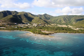
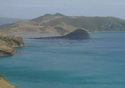
CBMR is on the southern coast of Antigua and includes four distinct wetlands, vast areas of seagrass beds and Cades Reef. Several coastal communities reside along the boundaries of the reserve and depend on these ecosystems for their livelihood and food security. Since its declaration, little work has been done to complete or implement a management plan for the area and no administrative arrangements are in place for its management.
Accordingly, this project will enable the Fisheries Division to focus on establishing management measures at the CBMR through the development of a management plan for the area while exploring linkages with other Fisheries-driven MPAs and creating opportunities for cooperation. The project will also focus on sensitising stakeholders about the CBMR and the management planning process. The project activities are designed to have a broad impact on the MPA network in Antigua and Barbuda with the end-product being more effective mechanisms for their management. Other outputs include a CBMR zoning plan and a CBMR monitoring plan. Recommendations will also be made on the establishment of an administrative framework for a national MPA network, and communication materials will be developed to help build community understanding of the importance of MPAs, both for MPAs in general and for CBMR in particular.
The CBMR lies within the larger southwest region of Antigua; the subject of a demonstration project under the GEF funded Sustainable Island Resource Management Mechanism (SIRMM). The activities under this project will support ongoing work to create an integrated management plan for that region of Antigua under SIRMM. For further information on the SIRMM project visit the website at http://www.gefantigua.org
For more information on this project please contact at CaMPAM or the Fisheries Division, Antigua at .
Photo: Cades Bay Marine Reserve (photo used with permission of the SIRMM Project - Antigua & Barbuda)
The Bahamas
Development and Effective Management of Marine Protected Areas in The Abacos
 The Bahamas National Trust (BNT) has led the implementation of the Mid-Size Project, which seeks to advance the efforts of the Caribbean Challenge Initiative. The following summary gives a snapshot of the project's progress based on 4 management components:
Management Planning
This is the first attempt to develop management plans for numerous Protected Areas (PAs). BNT has partnered with key organizations and Government Departments to ensure the requirements of a General Management Plan are met. The following activities have been completed to-date:
- Engaged Local Government Officials in the management planning process to build support for the project, and for involvement in management planning activities (Dec 2011).
- Established a core management team amongst BNT, The Department of Marine Resources (DMR), Friends of The Environment and scientists to assist with identifying existing data relevant to constructing management plans.
- Contracted a writer to consolidate data for the completion of two (2) management plans for the 4-Marine Parks and 2-Marine Reserves in Abaco managed by BNT and DMR respectively.
- Conducted two (2) management planning meetings/workshop.
- Conducted four (4) community meetings.
- Completed the 1st draft of 2 management plans for Walker's Cay National Park, Black Sound Cay Reserve, Fowl Cays National Park and Pelican Cays Land & Sea Park, and the No Name Cay & Crab Cay Marine Reserves.
Evaluation and Monitoring
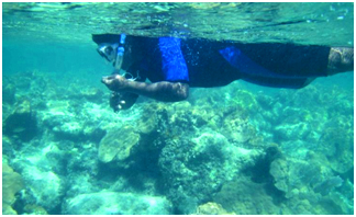
The Bahamas has concluded Reef Check as the standardized coral reef monitoring tool for MPAs. The Bahamas National Trust certified seven (7) individuals from Bahamas Customs, The Department of Marine Resources, The Bahamas National Trust, Bahamas Marine Mammal Research Organization and Dive Guana, in the Reef Check EcoDiver Training Course in Abaco, 21st – 23rd March, 2012, followed by Reef Check surveys in the Fowl Cays National Park. This training increased monitoring capacity to twenty-four (24) in-country, with twelve (12) residing in the Abacos.
Utilization of GIS and its layers
The Bahamas National Trust, in an effort to establish a functioning GIS Unit, has identified key individuals within the organization to undergo training. A total of five (5) representatives from BNT and DMR completed training in GIS Fundamentals I & II (26th – 30th March, 2012). GIS equipment and software has been purchased to enable the work of the newly formed unit.
Improvement of Community Involvement and Stakeholder Opinion
Education and outreach are critical to effective management of Protected Areas. Through the management planning process, community meetings and engagement with local governmental officials (Dec 2011 – Mar 2012) have aided in creating a sense of ownership and lasting support for PAs. Input from communities has facilitated the development of management plans and educational materials.
For more information on this project please contact at CaMPAM.
Photo: Reef Check participant conducts practice survey at Mermaid's Reef, Abaco
Dominican Republic
Increasing the Effectiveness of the Marine Protected Area System in the Dominican Republic
 The Dominican Republic (DR) is mostly surrounded by ocean and has a coastline that is approximately 1,600 km long. Along this coastline are important tropical and marine ecosystems, samples of which are legally protected through a system of 33 marine protected areas (MPAs) covering over 46,000 km2 of land and sea. There are also a number of coastal marine managed areas (MMAs) that play an important role in the sustainable use of coastal and marine resources. The existence of a legal structure to support the protection of samples of the nation's coastal and marine resources is a positive foundation for conservation and sustainable development, but the protected areas must also be effectively managed and linked through an ecologically connected network.
The MPA/MMA system in the DR is supported by many institutions (governmental and non-governmental) led by the Ministry of Environment and Natural Resources, centrally governed but regionally managed, with dependencies such as the Vice-Ministry of Coastal Marine Resources, the Vice-Ministry of Protected Areas and Biodiversity, the Environmental Police (SENPA), and, within the Ministry of Agriculture, the Fisheries Council (CODOPESCA). The government academic sector is led by the University of Santo Domingo's Marine Research Center (CIBIMA) and several MPA-related non-governmental organizations (NGOs) across the DR help to support MPA conservation and research initiatives.
This current project is part of the UNEP-CEP/CaMPAM project in support of the Caribbean Challenge ("Regional support for the Caribbean Challenge initiative: Networking, consolidation and regional coordination of MPA management" made possible with support from the Directorate General for Development Cooperation of the Italian Ministry of Foreign Affairs). It seeks to strengthen the structure of this MPA/MMA system in the DR, using existing successful models (eg. La Caleta MPA) to help encourage replication of similar efforts by other MPAs in the DR. The project will help to establish a framework to link the management of MPAs/MMAs in the DR with a combined work plan by the Ministries of Environment, Tourism and Agriculture, their dependencies, and local marine-based NGOs. At site level, the project will assess existing MPA management plans, propose a standard national approach for future MPA management planning, and help build the capacity of MPA personnel and stakeholders for effective MPA management, conservation and monitoring of existing MPAs in the DR.
For more information please contact at CaMPAM
Photo: Montecristi National Park, in the north-west of the Dominican Republic (José Alejandro Alvarez)
Grenada
Supporting the Development of an Effective National MPA Structure in Grenada: From Training MPA Wardens, Managers, and Board Members, To Raising Community Awareness and Developing Alternative Livelihood Skills
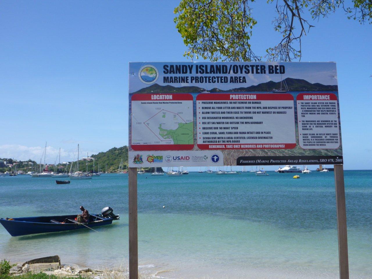 The Grenada Bank supports the most extensive coral reefs and related habitats in the south-eastern Caribbean, but the biodiversity of this region is at risk from increasing tourism, uncontrolled urban development and overfishing. Well-managed marine protected areas (MPAs) have an important role to play in the protection of the biodiversity of the Grenada Bank and, accordingly, Grenada has a Protected Areas System Plan. There are presently two established MPAs in Grenada – Sandy Island/Oyster Bed Marine Protected Area and Moliniere/Beausejour Marine Protected Area. The Fisheries Division is preparing for the launch of a third MPA, Woburn/Clarks Court Bay Marine Protected Area.
The two established MPAs both have existing management boards, staff and government support for operational costs such as salaries, fuel for patrol boats and office buildings. Whilst they are generally making good progress, the two MPAs share a need for improved communications with local stakeholders so as to build community support for MPA regulations and to ensure commitment to the operation of the MPAs from the highest levels of government.
Through this UNEP-CEP/CaMPAM project in support of the Caribbean Challenge ("Regional support for the Caribbean Challenge initiative: Networking, consolidation and regional coordination of MPA management" made possible with support from the Directorate General for Development Cooperation of the Italian Ministry of Foreign Affairs), the Grenada Fisheries Division, in collaboration with the Grenada Fund for Conservation, will work on raising awareness of the importance of MPAs in the communities surrounding the two established MPAs. The MPA wardens will receive training in environmental education so that they can visit local schools and take part in public events in the communities to raise public awareness and understanding of their adjacent MPAs. To further enhance communications, the project includes recruitment of an environmental communications/marketing specialist to help prepare environmental education materials, as well as to write articles, press releases and content for brochures, signs and websites, and to successfully distribute these materials.
With the forthcoming launch of Woburn/Clarks Court Bay Marine Protected Area, the project will facilitate work on various aspects of the MPA management plan and related zoning plans for this MPA. With demands on all the MPAs expected to increase in the future, there will be a need for greater board effectiveness in supporting strengthened management. The project will enable the preparation, and presentation, of condensed summaries of the management plans of the two established MPAs to their respective boards and key stakeholders. The project will also provide board effectiveness training to members of the three MPA boards. In this way, the project will bring the same level of planning to Grenada's newest MPA as to the existing MPAs, and help ensure cohesion in national MPA management.
For more information please contact at CaMPAM
Photo: Sandy Island/Oyster Bed Marine Protected Area, Carriacou (Davon Baker)
St. Kitts and Nevis
Building Infrastructure and Development of a Framework for the Management of Marine Protected Areas in St. Kitts and Nevis
 Although St. Kitts and Nevis has a relatively small ocean shelf area surrounding both islands, it has a representative cross-section of marine life including endangered corals, marine mammals, fish species, and sea turtles. The diversity of corals ranges from species categorized as critically endangered such as staghorn (Acropora cervicornis) and elkhorn (Acropora palmata), to the more common finger coral (Porites divaricata). Complementing the hard coral varieties are an array of sponges and soft corals.
The coastal waters around St. Kitts and Nevis are used for a wide range of activities. Tourism is presently the major economic driver and stretches of the coast are dominated by coastal tourism development, private yachts, cruise ships, and associated water activities. Additionally, commercial and artisanal fisheries form a significant part of the local economy. Fisheries involve vessels of varying sizes and capacities, using a variety of gear types and fishing strategies and covering a large part of the coastal waters. The inter- and intra-island transportation needs of a small coastal state (including ferries, cruise ships, personal recreation vessels, and large industry vessels) have resulted in a congested marine environment with mounting conflicts. There is a large number of vessels using the water ways of St. Kitts and Nevis, and there is a significant amount of anchor damage to the remaining reefs.
This new project under the UNEP-CEP/CaMPAM project in support of the Caribbean Challenge ("Regional support for the Caribbean Challenge initiative: Networking, consolidation and regional coordination of MPA management" made possible with support from the Directorate General for Development Cooperation of the Italian Ministry of Foreign Affairs) will enable the installation of mooring buoys at the proposed site for a Marine Management Area (MMA). The moorings will help prevent damage to the remaining coral reef areas from the anchors of boats, and will provide necessary infrastructure for the MMA.
Although St. Kitts and Nevis does not yet have any designated marine protected areas, in the past two years some major steps have been taken to provide for the management of marine resources. These have included the drafting of the protected areas systems plan (under the OECS Protected Areas and Associated Livelihoods (OPAAL) Project), completion of a socio-economic monitoring process for fishers (the Ecosystem Management Approach to Fisheries project with the University of the West Indies, CERMES), and a year-long process to develop a multiple use marine zoning design (under USAID BioTA project conducted in partnership with The Nature Conservancy).
The new project will help St. Kitts and Nevis to work on the establishment of a framework for the management of Marine Protected Areas. This will build on the foundation of work recently completed under the Protected Areas System Plan, and will see the next steps taken towards designating and completing the first nation-wide marine zoning plan in the Caribbean. This will include a review of the draft design by a steering committee, as well as by stakeholders, in order to refine the uses within each zone, build connections with other initiatives, and to develop a strategy for broader stakeholder consultations.
For more information please contact at CaMPAM
Photo: The Great Salt Pond on the Southeast Peninsula of St Kitts (Marc Williams)
St. Lucia
Training Teachers to Increase Student Awareness and Understanding of the Importance of Marine Protected Areas in Saint Lucia
 To date, a total of twenty-four marine reserves have been designated by the Department of Fisheries in Saint Lucia. Management responsibility for the marine reserves is shared among the Department of Fisheries, the Saint Lucia National Trust, and management committees that are specific to particular reserves. A key part of the Saint Lucia National Trust's mandate is to raise awareness and understanding of the issues affecting the country's natural heritage. The desire to fulfil this mandate has driven the development of the current project which focuses on education to effect change in the mindset of Saint Lucians about the importance of their marine reserves.
As an active member of the United Nations Environment Programme's Caribbean Environment Programme (UNEP-CEP), Saint Lucia has taken part in a number of UNEP-CEP activities under the framework of the Protocol Concerning Specially Protected Areas and Wildlife in the Wider Caribbean Region (SPAW), in support of marine protected areas (MPAs) and threatened species conservation, including activities through the Caribbean Marine Protected Areas Managers Network and Forum (CaMPAM) and the Wider Caribbean Sea Turtle Conservation Network (WIDECAST).
Following Saint Lucia's participation in CaMPAM's 2009 course on Marine Protected Area Management, the Department of Fisheries conducted a needs assessment among a group of Life, Earth and Social Science Secondary School Teachers which showed that none of them had received any training related to Marine Science or Marine Education. Nearly two-thirds rarely or never took their students on field trips to visit marine habitats, and a full two-thirds rarely or never requested the assistance of natural resource specialists as guest lecturers on marine-related issues. However, all the teachers either strongly agreed or agreed that if they were trained in marine environmental education they would be willing to incorporate the skills they gained into their lesson plans.
Since becoming aware of the findings of this assessment, the Department of Fisheries and the Saint Lucia National Trust have been keen to address shortcomings in environmental education. Accordingly, this new project, through the UNEP-CEP/CaMPAM project in support of the Caribbean Challenge ("Regional support for the Caribbean Challenge initiative: Networking, consolidation and regional coordination of MPA management", made possible with support from the Directorate General for Development Cooperation of the Italian Ministry of Foreign Affairs) will develop an annual teachers' professional development course on marine environmental education. The project aims to complement other activities that are ongoing in Saint Lucia in relation to the strengthening of MPAs, and will draw on best practices in marine environmental education both within and outside the Caribbean region. A key partner in this project will be WIDECAST, whose experience and existing materials related to marine environmental education will be incorporated into the teachers' course.
The schools in the area of the Point Sables Environmental Protection Area (PSEPA), for which the Saint Lucia National Trust has management responsibility, have formed a committee called the 'Schools Advocating to Value the Environment' (SAVE) which seeks to promote environmental conservation of the area. This group of schools will be a key partner in the design and piloting of the teachers' professional development course on marine environmental education. The project also includes developing a teachers' guide to accompany the course, promoting participation in the course to target teachers and promoting the inclusion of the marine environment in school lesson plans in future.
For more information please contact at CaMPAM
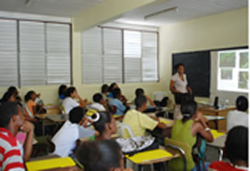
Photo: Youth Environmental Forum, Saint Lucia (Denia George, SLNT)